By Roselyn Fauth
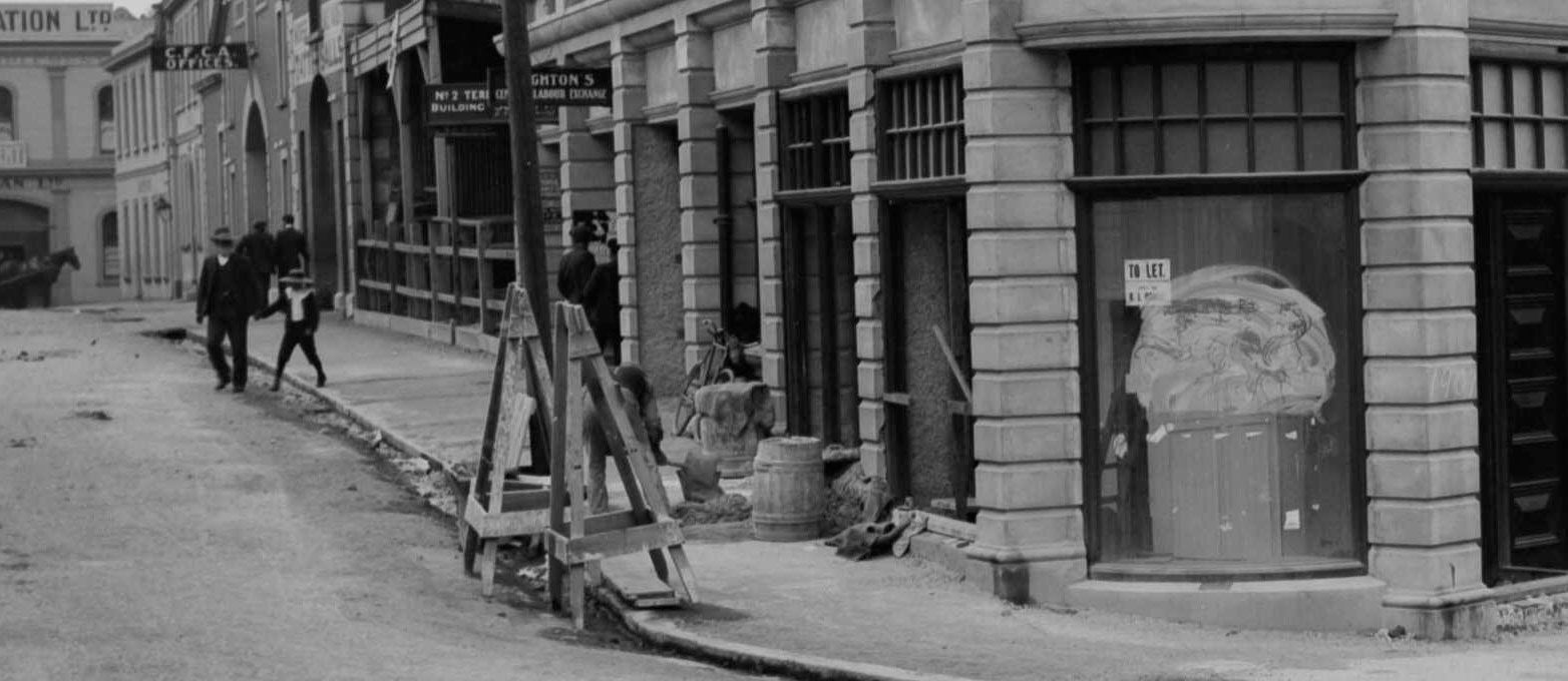
1900 Beswick and Stafford Street_PA-Group-00103- detail showing footpath maintenance-National Library 692727
Next time you walk through Timaru, look down... not at your phone... at the kerb.
That dark blue grey in our central business district footpaths might look ordinary, but it can tell a huge story: ancient lava, local quarrying, dusty bullock roads, stormwater, public health, council decisions, street names, footpaths, lighting, hidden services and the making of Stafford Street.
A kerb marks the boundary between road and footpath. Beside it is the channel, the shallow gutter that carries rainwater away. Together, they do something quietly brilliant. They organise the street.
They tell vehicles where to be, pedestrians where to walk, and water where to go. Which is quite a lot of responsibility for something most of us only notice when we trip over it!
In Timaru, some of those dark blue grey street edges are made from local bluestone, a basalt formed from ancient lava. So, in one of those slightly wonderful historical twists, part of the polite little edge of the footpath began life as a volcanic event...

1909 Photograph taken by an unidentified photographer employed or contracted by 'The Press' newspaper of Christchurch. Stafford Street, Timaru, with carts, horses and people in the street. The Press (Newspaper) :Negatives. Ref: 1/1-008815-G. Alexander Turnbull Library, Wellington, New Zealand. /records/29944621. The stone building was the former Timaru and Gladstone Board of Works Building at 95 Stafford Street, Timaru. Constructed with bluestone to the architectual design of Thomas Roberts and the construction work by contractor Thomas Machin in an Italianate style. A brick extension was possibly added c1955
When this building opened in 1874, South Canterbury was still part of Canterbury Province, which was governed from Christchurch. Many people in Timaru and the surrounding district felt that South Canterbury needed more local control, especially over practical matters such as roads, bridges, land revenue and harbour improvements.
The Timaru and Gladstone Board of Works was created in 1867 as a compromise. It did not make South Canterbury independent, but it did give the district a local public body with the power to spend money from land sales and other income on important public works.
By the time the board’s purpose-built offices were completed in 1874, the building represented South Canterbury’s growing confidence and desire to manage its own affairs. However, the board lasted only a short time. In 1876, New Zealand’s provincial government system was abolished, and the board came to an end.
After this, the building passed to the Crown and was used by the Lands and Survey Department. Additions were made to the rear in the mid-20th century, and the building was later used for storage. Today it is known as the Gladstone Building and provides commercial office space.
The architect of the buiding was Thomas Roberts. He trained as an engineer before emigrating to Canterbury, New Zealand, in 1870. He designed the Gladstone Board of Works Building, and Sealy House (1875) Now known as Shand House at Craighead Diocesan School, this residence remains a fine example of Victorian domestic architecture. He also designed the Union Bank of Australia (1876–77): Situated on Stafford Street, this building exemplified the solidity and confidence of the financial sector in a growing town. And then the Wrecks Monument (1883–1885): A somber but striking monument commemorating maritime tragedies off the Timaru coast, contributing to the town’s civic memory. Roberts left Timaru in 1890 to join the New Zealand Midland Railway Company, eventually becoming the Assistant Engineer in charge of the Nelson District for the Public Works Department in 1895. By 1901, he returned to private practice in Nelson before leaving the city around 1905.
The contractor for this Gladstone building was Thomas Machin. He married Annie Holmes in 1857 at St Mary Magdalene, Bermondsey, Surrey. They arrived at Lyttelton on the Roman Emperor in January 1860. He is listed on the ships occupation record as a 23-year-old bricklayer. With him were his wife Anne, aged 22, and their two-year-old daughter Anne. A son, Thomas Dewar Machin, was reportedly born aboard the Roman Emperor in January 1860 and died as an infant in Christchurch shortly after arrival.
Ancient lava, now working in municipal drainage.
You have to admire the career change. A dusty bullock road in daily life back in the day, it was a problem.
In dry weather, dust travelled into shops, homes, eyes, lungs, clothing and goods. In wet weather, the same road could become mud, ruts and puddles. Wheels sank. Hooves churned the surface. Pedestrians picked their way around muck. Shopkeepers traded beside public space that was part road, part drain, part obstacle course.
A growing town could not leave that to chance. So at some point, someone had to say: this is where people walk, this is where wheels go, and this is where the water drains. That is when a rough route begins to become a street.
Streets had to be shaped. Water had to be directed. Footpaths had to be raised, edged and surfaced. Kerbs marked the line between vehicles and pedestrians. Channels carried rainwater away. Asphalt made walking easier.
Later, the road corridor also became the place where many of the town’s hidden services could be installed, reached, repaired and upgraded.
That is the part of street history we can often forget, the road is only the visible layer.
Beneath and beside it are the systems that let urban life function: stormwater, wastewater, water supply, lighting, power, telecommunications, crossings, signs, sumps, drains, service covers and repairs. The 1905 Timaru Borough Drainage, Sewerage, and Loans Act is a useful reminder that drains, drainage works and sewerage responsibilities became formal civic matters as the borough grew.
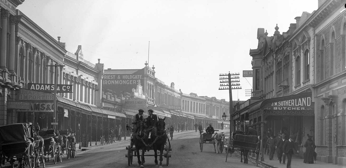
1900. Looking along Stafford Street, Timaru, circa 1900. A horse drawn carriages is driving towards the camera. Other carriages are also visible. Both sides of the street are lined with businesses. On the right is the shop of J W Sutherland - butcher. On the left there are signs advertising J T Cooper - dentist, Adams & Co - drapers and importers, Arthur A Ware - printer and stationer, and Priest & Holdgate - ironmongers. Taken by Steffano Webb. Aviation National Library 133657
If a road is not just something we travel over, what is it? It's also a civic network.
When stormwater does not drain, streets flood. When surfaces break down, movement becomes harder. When services need repair, roads and footpaths are opened up. When crossings are poorly designed, people are excluded or put at risk. When streets are improved, the benefits are not only practical. They change how people feel about moving through their town.
So when we look at a bluestone kerb, we are not only looking at a piece of stone. We are looking at one visible edge of a much larger civic system. And over time, the street became the place where the town’s public services could be organised, maintained and improved.
Who decided which streets were improved first? Who paid for kerbing and channelling? Who maintained the drains? Who laid the asphalt? Who quarried and cut the stone? Who benefited from safer, drier, cleaner streets? Who was still left walking through mud?
These are not just questions about the past. They are questions about how communities make public places work.
That is why Timaru’s bluestone matters. It is a material, yes. But it is also a clue. It helps us read the town as a record of choices: geological, practical, political, financial, technical and social.

1900 Street scene, Stafford Street, Timaru, including horses and carts. The Press (Newspaper) :Negatives. Ref: 1/1-008712-G. Alexander Turnbull Library, Wellington, New Zealand. /records/29945985
Milestone 1: About 2 to 2.5 million years ago
Lava creates the material
Long before there was a Stafford Street, a borough council, a footpath, or anyone writing stern letters about roadworks, lava flowed from the Mount Horrible and Wapouri area towards the coast.
Te Ara records that lava from near Mount Horrible reached the coast at Timaru about 2 to 2.5 million years ago, forming reefs that later helped shelter vessels. University of Otago describes Wapouri / Mount Horrible, inland from Timaru, as the site of the youngest volcanic episode in the South Island, producing the Timaru basalt.
This basalt is the origin of Timaru bluestone.
Modern Timaru Bluestone Industries describes the stone as blue grey vesicular basalt. “Vesicular” simply means it has small holes formed by gas bubbles in cooling lava. Those little marks are not flaws in the story. They are evidence of the stone’s beginning.
At Dashing Rocks, the volcanic story is still visible. Timaru District Council describes waves breaking against two-million-year-old lava from Mount Horrible and notes basalt columns formed as the lava cooled and cracked.
So before bluestone was a kerb, it was landscape.
Before it was infrastructure, it was lava.
And before anyone quarried, cut, dressed or carted it, it was part of the physical making of Timaru itself.
What changes when we realise a footpath material is also part of the landscape beneath us?
Milestone 2: 1856
A town begins on paper
In 1856, the Canterbury provincial government sent surveyor Samuel Hewlings to Timaru. A Timaru District Council heritage assessment records that it was already expected Timaru would become the main town of South Canterbury, and that Hewlings surveyed the “government town” between North Street and Patiti Point.
Surveying sounds neat. Lines, sections, measurements, boundaries.
But a survey is also an act of imagination. It says: this may be a town. Here will be streets. Here will be frontages. Here will be public responsibilities.
Samuel Hewlings was not laying a kerb or cutting stone. But without survey, there is no clear street to improve, no frontage to manage, no public space to maintain.
A line on a plan does not stop mud or drain water, it doesn't make walking easier either. But it begins the process of deciding where public space will be, who will use it, and who will have to look after it.
Who gets to draw the lines that later become streets, boundaries and public places?
Milestone 3: December 1868
Fire changes the rules
Before Stafford Street became the high street later generations knew, Timaru faced one of the great urban dangers of the nineteenth century: fire.
After the major fire of December 1868, masonry became part of Timaru’s rebuilding story. Masonry means building with hard, durable materials such as stone or brick. The Timaru District Council Stafford Street heritage assessment notes that bluestone, brick and cement plaster are visible in the area, reflecting post-fire requirements to build in masonry and the work of local builders.
This matters because disasters often change what a town thinks is acceptable.
A fire can turn “that will do” into “never again”.
Timaru’s shift towards stronger materials was practical, but it was also civic. It was about safety, permanence and confidence.
Bluestone fitted that moment.
It was local. It was hard. It could be worked. It could take knocks. It could become part of buildings, bridges, kerbs, paving and civic works.
But stone does not politely organise itself into a town.
Every kerb stone represents labour: quarrying, sorting, cutting, dressing, carting and setting. Not every piece of basalt becomes a good kerb or paving stone. The stone has to be selected. It is heavy, hard, variable and demanding on tools and hands.
That labour is part of the heritage too.
When disaster changes a town, who decides what should be rebuilt, and what should be done differently?
Milestone 4: 1875
Great North Road appears on the map
By 1875, Timaru’s developing townscape was being recorded in maps such as the Plan of Timaru Townships, Canterbury, N.Z., lithographed at the Lyttelton Times Office.
Your 1875 map is important because it identifies the main route as Great North Road, not Great South Road. This matches the Timaru District Council Stafford Street heritage assessment, which records that Stafford Street was known as Great North Road until September 1889.
This might sound like a small correction. It is not... A name on a map is evidence. It lets us test later memories, repeated wording and local assumptions against the historical record.
History is not just collecting old facts. It is checking them.
Sometimes the past changes slightly because we find better evidence.
And sometimes that evidence is sitting quietly on a map, waiting for someone to notice.
What else might shift when we stop repeating a story and go back to the source?
Image caption: Plan of Timaru Townships, Canterbury, N.Z., 1875. Scale 3 chains to an inch. Lithographed at the Lyttelton Times Office, Christchurch, N.Z.
Milestone 5: 25 January 1887
The council debates mud
One of the best moments in this whole story appears in an 1887 Timaru Herald report of a Timaru Borough Council meeting.
Councillor Hill, an elected borough councillor involved in public works decision-making, moved that the Foreman of Works should be advised not to allow the streets to be “ploughed and harrowed” in future. Instead, council workers should be employed improving footpaths by asphalting.
That phrase, “ploughed and harrowed”, is perfect.
It is the whole transition in three words.
Ploughing and harrowing belong to paddocks. To soil. To rough ground. Yet here they are in a debate about streets.
Timaru was still close enough to its rougher beginnings that street maintenance could sound agricultural. But the debate was changing. Councillors were discussing kerbing, channelling and asphalting. They were deciding how public labour should be used, which work mattered, and where public money should go.
Councillor Jackson, another elected councillor in the debate, proposed an amendment that the Foreman of Works use his discretion about harrowing the streets, and that any asphalting be done where kerbing and channelling had already been made.
There it is: governance in the mud... Not grand speeches or a ceremonial unveiling. Just councillors, winter, public money, road surfaces, workmen, drainage and the question of what kind of town Timaru was becoming.
If public money is limited, which streets should be improved first, and who gets to decide?
Milestone 6: 27 February 1889
Bluestone holds the line on Woollcombe Street
Two years later, a small Timaru Herald notice gives us one of the clearest glimpses of the system in action.
The report described improvements being carried out by Mr David Owers at the shop on the corner of the Main Road and Woollcombe Street. Owers appears here as a local property or business figure connected with improving a street frontage.
The newspaper reported that the Woollcombe Street footpath had been “kerbed in bluestone”, “channelled in concrete”, and was being asphalted.
That one sentence is a masterclass in urban infrastructure.
The bluestone kerb held the edge while the concrete channel carried the water away, and the asphalt made the walking surface. Each material had a job. And you couldn't just whack it in, you needed to get the fall right, the surfaces safe.
What can one small street improvement tell us about how a town learns to organise itself?
Milestone 7: September 1889
Great North Road becomes Stafford Street
Timaru District Council’s Stafford Street heritage assessment records that Stafford Street was known as Great North Road until September 1889, when it was renamed in honour of Edward Stafford. Stafford was a former Member of the House of Representatives for Timaru and Premier of New Zealand on three separate occasions between 1856 and 1872.
A route is a way through but a street can also take us on a journey of civic place and pride. By naming the street, Timaru was doing more than tidying up a map. It was attaching memory, politics and public identity to the town’s main thoroughfare. The Council heritage assessment describes Stafford Street as a colonial shopping and commercial thoroughfare that demonstrates Timaru’s growth in the later nineteenth and early twentieth centuries. So the kerb is not just a construction detail. It belongs to the making of the high street.
Who is remembered in street names, and whose stories sit beneath or beside those names?
Milestone 8: 1905 and after
The hidden systems become official
The surface of the street is only the beginning really. As Timaru grew, the town also had to manage drainage, sewerage and public health. The Timaru Borough Drainage, Sewerage, and Loans Act 1905 gave formal legal structure to public drains, drainage works and sewerage responsibilities in the borough.
This is where the street becomes even more interesting, as a street is not only a route. It is a corridor for services.
Water. Wastewater. Stormwater. Power. Lighting. Telecommunications. Repairs. Access points. Sumps. Pipes. Covers. Trenches.
Much of the city is hidden underfoot, and much of it I imagine we take for granted. But when these systems work, they vanish from our attention. When they fail, they become everyone’s problem.
What hidden systems do we rely on every day without seeing them?
Milestone 9: Christmas Eve 1907
The street lights up
By the early twentieth century, Stafford Street had become a place of public gathering and civic pride.
The Timaru District Council heritage assessment records that thousands of residents crowded into Stafford Street on Christmas Eve 1907 to witness the new electric streetlights being turned on for the first time.
Imagine that moment... A street that had once been rough, dusty, practical and shaped by carts and hooves had become a place where people gathered to see technology arrive. Lighting changed the experience of the street. It affected visibility, safety, evening movement, display and confidence.
It also reminds us that progress comes in layers.
First a route, surveyed town, buildings, kerbs, channels and asphalt. Then drains and services. Then lighting. Then traffic systems, crossings, accessibility upgrades, repairs and renewals. A town is never finished. It is always being remade.
How does a new technology change who feels safe, welcome or able to use a public place?
Milestone 10: Late twentieth century
Heritage becomes part of renewal
In the late twentieth century, as State Highway 1 was being rerouted away from Stafford Street, heritage enhancement became part of central business district revitalisation.
The Council heritage assessment records that reinforcing the late Victorian and Edwardian character of the CBD was seen as beneficial for the city, and that Trust Bank South Canterbury provided low-cost finance to improve and strengthen commercial facades.
This is another kind of civic decision-making.
Earlier generations had focused on forming streets, controlling water, improving footpaths and building more durable structures. Later generations began to see historic character itself as a public asset.
That does not mean freezing the town in time.
Towns have to work. Footpaths need to be safe. Crossings need to be accessible. Drains need to function. Services need repair. Streets must serve people who walk, drive, wheel, shop, work, visit, maintain and deliver.
But heritage can guide change.
It can ask: what should we keep?
- What can we adapt?
- What should we record before it changes?
- What materials make this place feel like itself?
- When a town changes, how do we decide what should be kept, what should be adapted, and what can be let go?
Milestone 11: Today
Bluestone still asks a question
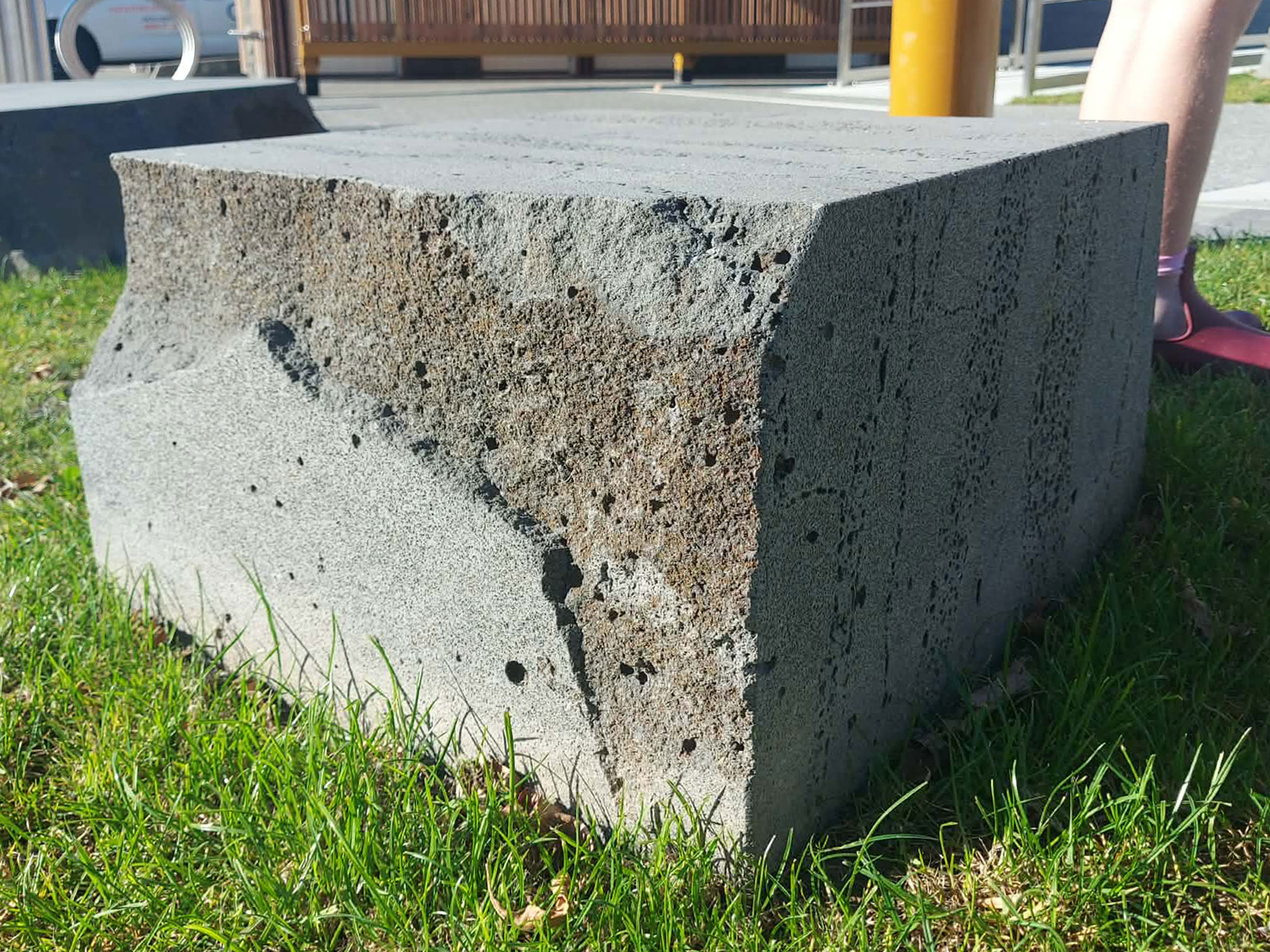
Timaru bluestone is still quarried, selected and worked. Timaru Bluestone Industries describes it as volcanic basalt quarried in South Canterbury and crafted into residential, commercial and civic projects, including paving, tiles, kerb and channel, outdoor furniture, memorials, bollards and landscape details.
The company’s fabrication information describes a process that moves from quarry to cutting and finishing, with checks for weakness in the rock, damaged surfaces, unsuitable colour and oversized holes caused by air bubbles.
That detail matters because bluestone is more than just a heritage material. It is still a working material. It has to be selected, finished, installed and maintained properly.
The challenge today is not to put bluestone everywhere. It is to use it well.
In the right places, bluestone can add durability, local identity and meaning. But public places must also meet modern needs for safety, drainage, access, repair and comfort.
A beautiful kerb that creates a barrier is not enough. A smooth surface that erases local character may not be enough either. Good public space has to hold more than one value at a time. How do we balance heritage, safety, cost, accessibility, maintenance and the character of a place?
What the kerb helps us notice
Bluestone is the thread, but the bigger story is change. Timaru’s street edge helps us see how a town moves from landscape to route, from route to surveyed settlement, from settlement to civic centre, and from civic centre to heritage place.
It also helps us see people.
- Samuel Hewlings, the surveyor, represents planning.
- Councillor Hill represents elected decision-making and public works priorities.
- Councillor Jackson represents debate, amendment and compromise.
- The Foreman of Works represents implementation.
- Mr David Owers, connected with the 1889 Woollcombe Street frontage improvements, represents private frontage and local business investment.
- Quarry workers, stone cutters, cartage workers and builders represent labour.
- Modern council staff, contractors, engineers, planners and heritage advocates represent ongoing responsibility.
- Pedestrians, students, workers, shoppers, cyclists, mobility scooter users, drivers and visitors represent the public who live with the results.

Corner of Stafford, Church and Strathallan Streets. Store SC Dresden - sold pianos. The Old Bank Hotel Robert Bowie, Stafford St., sold pickles.
That is the civic story.
People making decisions about shared space, doing the work and using the place.
When old stone kerbs, channels or paving details survive, they deserve to be noticed and recorded before works begin. They may look ordinary, but they are part of the town’s historic fabric. Good heritage practice does not mean freezing a street in time. It means understanding what is there before deciding what should happen next.
Questions to carry into the street
Next time you walk through Timaru, look down.
Notice the kerb, the channel, the slope of the footpath and the surface under your feet.
Then ask:
- Who planned this?
- Who paid for it?
- Who built it?
- Who maintains it?
- Who benefits from it?
- Who might find it difficult to use?
- What evidence tells us how it changed?
- What older stories are missing from the street record?
- What should we protect, adapt or record before future work is done?
These are not just heritage questions. They are questions about public space, shared responsibility, evidence, access, memory and change over time.
Timaru’s bluestone street edges remind us that history is not only kept in museums, archives or grand buildings... they also can sit taken for granted in a path or edge of the road.
A kerb may look simple, but it can hold a complicated story: lava flow, to kerb and channels as a milestone civic order. Timaru’s bluestone shows us that towns are built in layers. Some layers are grand and easy to see. Others are ordinary, practical and underfoot. But if we learn to read them, they can teach us how communities make decisions, solve problems, remember the past and shape the future.
A kerb, yes... But also a civic record underfoot.

1910 New Zealand Government Life and Accident Insurance building, Stafford Street, Timaru, with men, horses and carts in the foreground. The Press (Newspaper) :Negatives. Ref: 1/1-008809-G. Alexander Turnbull Library, Wellington, New Zealand. /records/29939829

1911 A fleet of motor cars in parade, on a street lined with commercial buildings, Timaru, to celebrate the coronation of George V. The Press (Newspaper) :Negatives. Ref: 1/1-008618-G. Alexander Turnbull Library, Wellington, New Zealand. /records/29944218

Photo of the Timaru Landing Services Building - Courtosey of Phil Brownie

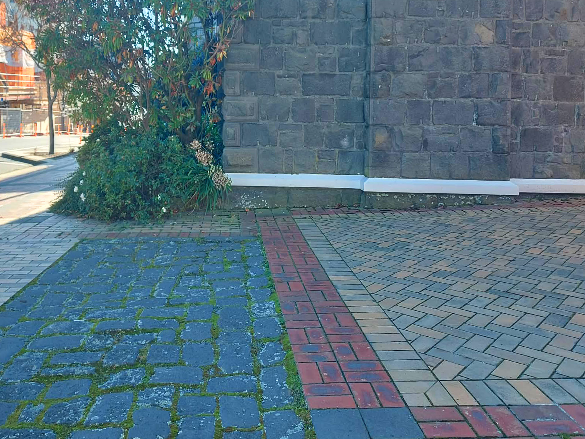
Bluestone Cobbles on the south side of the Gladstone Board of Works 2026. Photography By Roselyn Fauth
Timaru CBD - Bluestone - Maori Design by Francine Spencer_StrathallanCorner_PhotoRoselynFauth2026 Detail Block
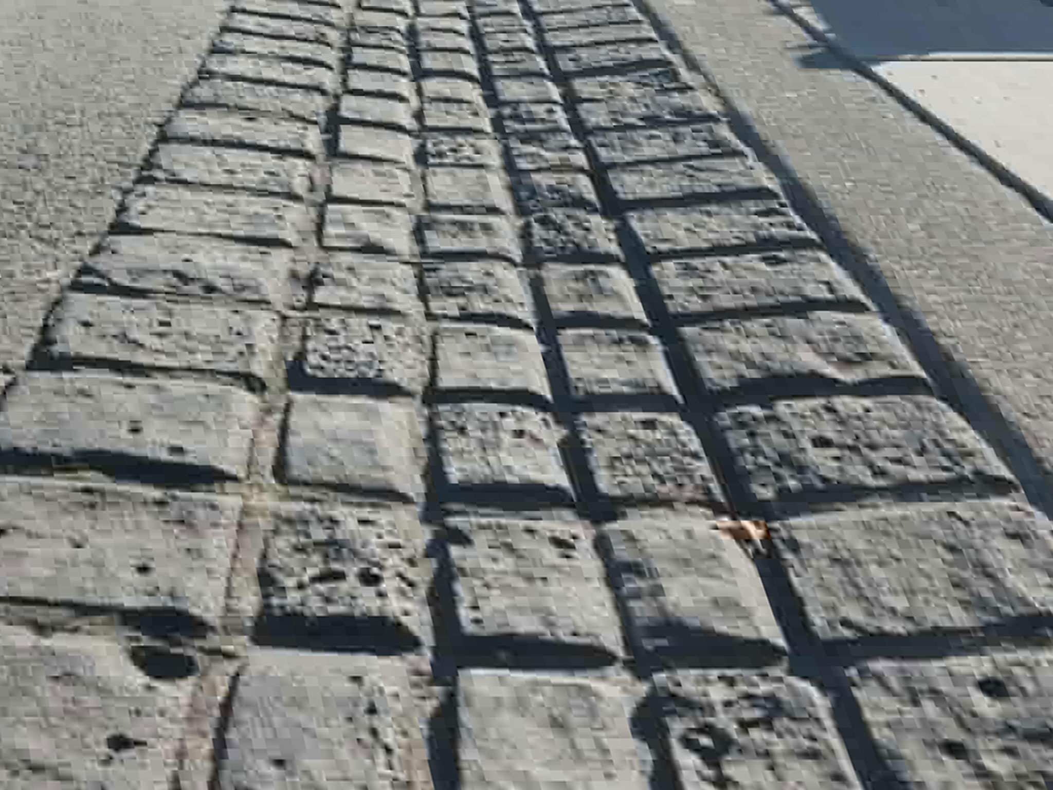
Cobbles incorporated into the CBD drains
An original dirt bullock trail was referred to as the Great North Road. In 1889 at a Council meeting it was proposed and carried "that the Main road from Whale's Creek to its junction with King Street be named Stafford Street." Named after Sir Edward Stafford, formerly M.H.R., for Timaru (he was also Nelsons first super intendant). His free, secular and compulsory education system became the model for New Zealand. At the 1855 election he became a member of the House of Representatives for Nelson, a seat he held until 1868 when, after local disputes, he resigned and became member for Timaru. Learn more here
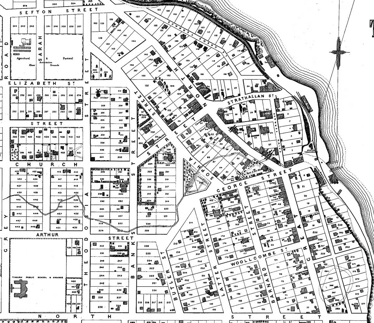
Plan of Timaru Townships, Canterbury, N.Z., 1875. Scale 3 chains to an inch. Lithographed at the Lyttelton Times Office, Christchurch, N.Z. - Courtesy of the Timaru District Council
Timaru town. NZ Heritage Maps Platform, https://maps.recollect.co.nz/nodes/view/1138

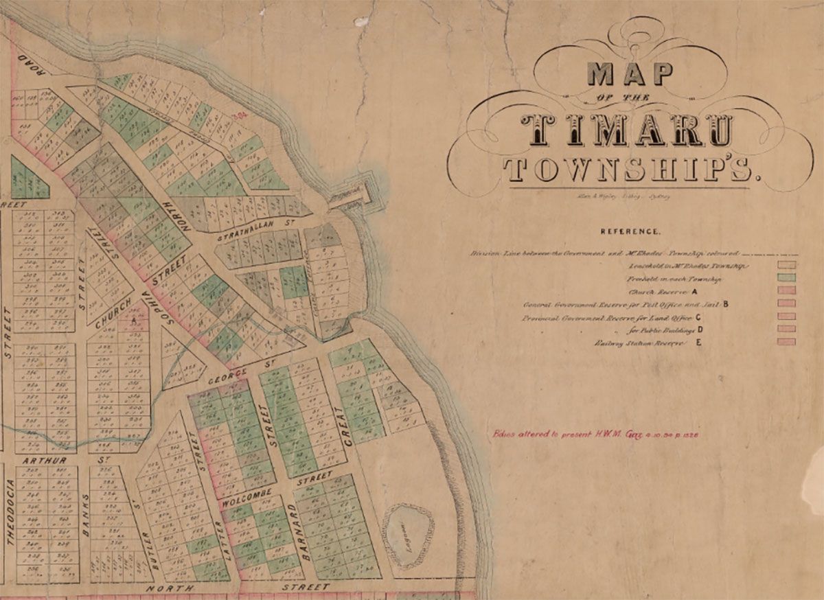
A colour printed map of Rhodes Town, circa 1885. Shows properties owned by W B Rhodes, R H Rhodes, and G Rhodes, as well as local railway lines, the harbour, streets, and notable buildings. Covers the area bordered by Wai-iti Road in the north, North Street in the south, and from the coast as far as William Street in the west. The original blue and red tints were used to designate let and unlet properties held by the Rhodes Brothers. The lower left corner gives the credit: "Compiled by McIntyre and Leur's Authorised Licensed Surveyors Christchurch". Scale 3 chains to 1 inch. South Canterbury Museum M0001
Sources
Key evidence includes Te Ara and University of Otago material on Timaru basalt and the Mount Horrible / Wapouri volcanic landscape; Timaru District Council information on Dashing Rocks and the Stafford Street Historic Heritage Area; Timaru Herald reports from 1887 and 1889 through Papers Past; the Timaru Borough Drainage, Sewerage, and Loans Act 1905; and Timaru Bluestone Industries information on present-day bluestone use and fabrication. Your 1875 map showing Great North Road strengthens the correction from “Great South Road” to “Great North Road”.
Te Ara, South Canterbury region, landscape and geology:
https://teara.govt.nz/en/south-canterbury-region/page-2
University of Otago, Wapouri / Mount Horrible, South Island’s youngest volcano:
https://www.otago.ac.nz/postgraduate-study/research-opportunities/wapouri-mount-horrible-south-islands-youngest-volcano
Timaru District Council, Dashing Rocks:
https://www.timaru.govt.nz/community/recreation/walking-and-cycling/dashing-rocks
Timaru District Council, Stafford Street Historic Heritage Area Assessment Report:
https://www.timaru.govt.nz/__data/assets/pdf_file/0006/674034/Historic-Heritage-Historic-Heritage-Area-Assessment-Report-HHA1-Stafford-Street-Historic-Heritage-Area.pdf
Timaru Herald, 25 January 1887, Borough Council report, Papers Past:
https://paperspast.natlib.govt.nz/newspapers/THD18870125.2.26
Timaru Herald, 27 February 1889, Woollcombe Street improvements, Papers Past:
https://paperspast.natlib.govt.nz/newspapers/THD18890227.2.8
New Zealand Legislation, Timaru Borough Drainage, Sewerage, and Loans Act 1905:
https://www.legislation.govt.nz/act/local/1905/5/en/latest/
Timaru Bluestone Industries:
https://www.timarubluestone.co.nz/
Timaru Bluestone Industries, Stone Fabrication:
https://www.timarubluestone.co.nz/stone-fabrication/
