By Roselyn Fauth
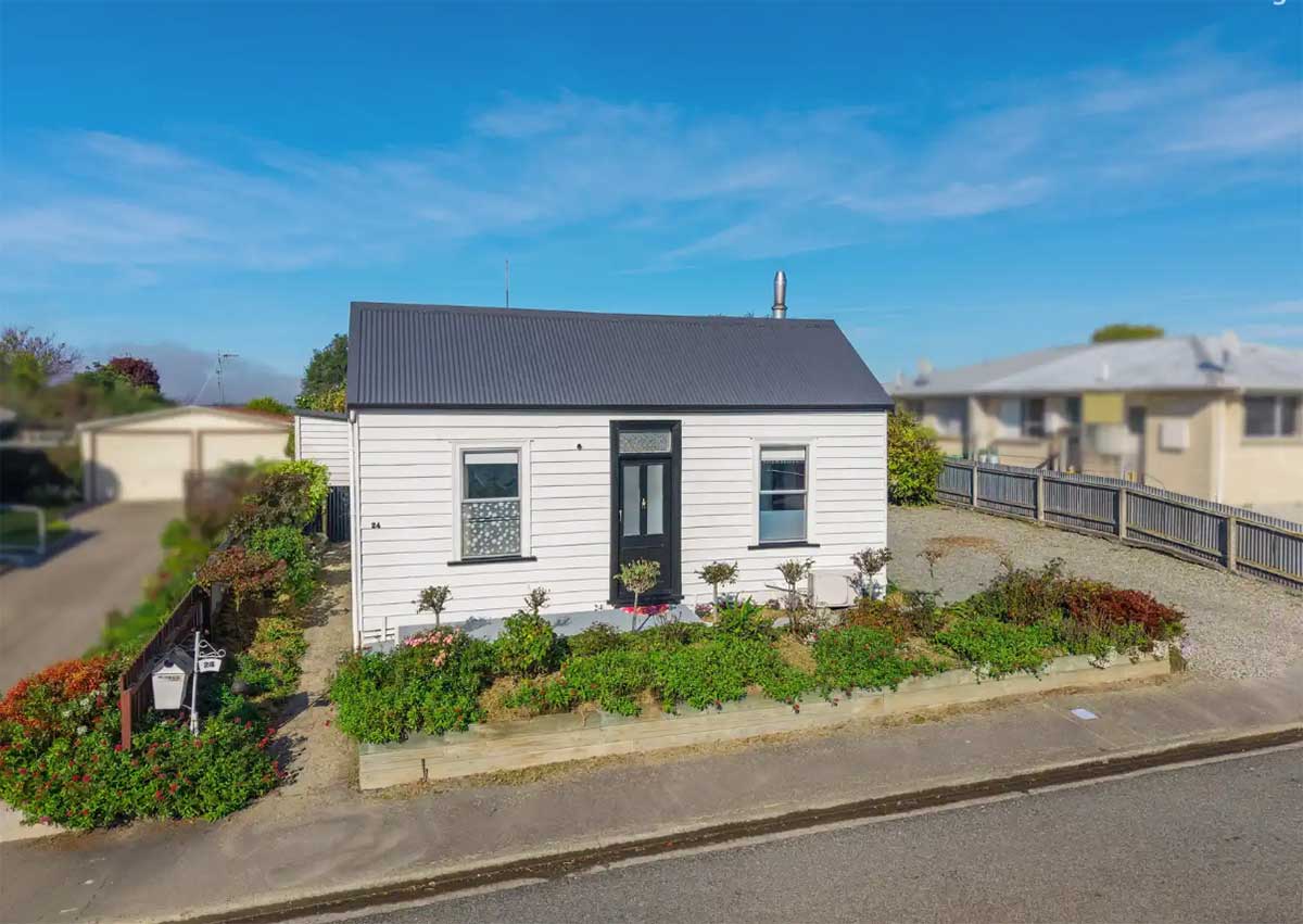
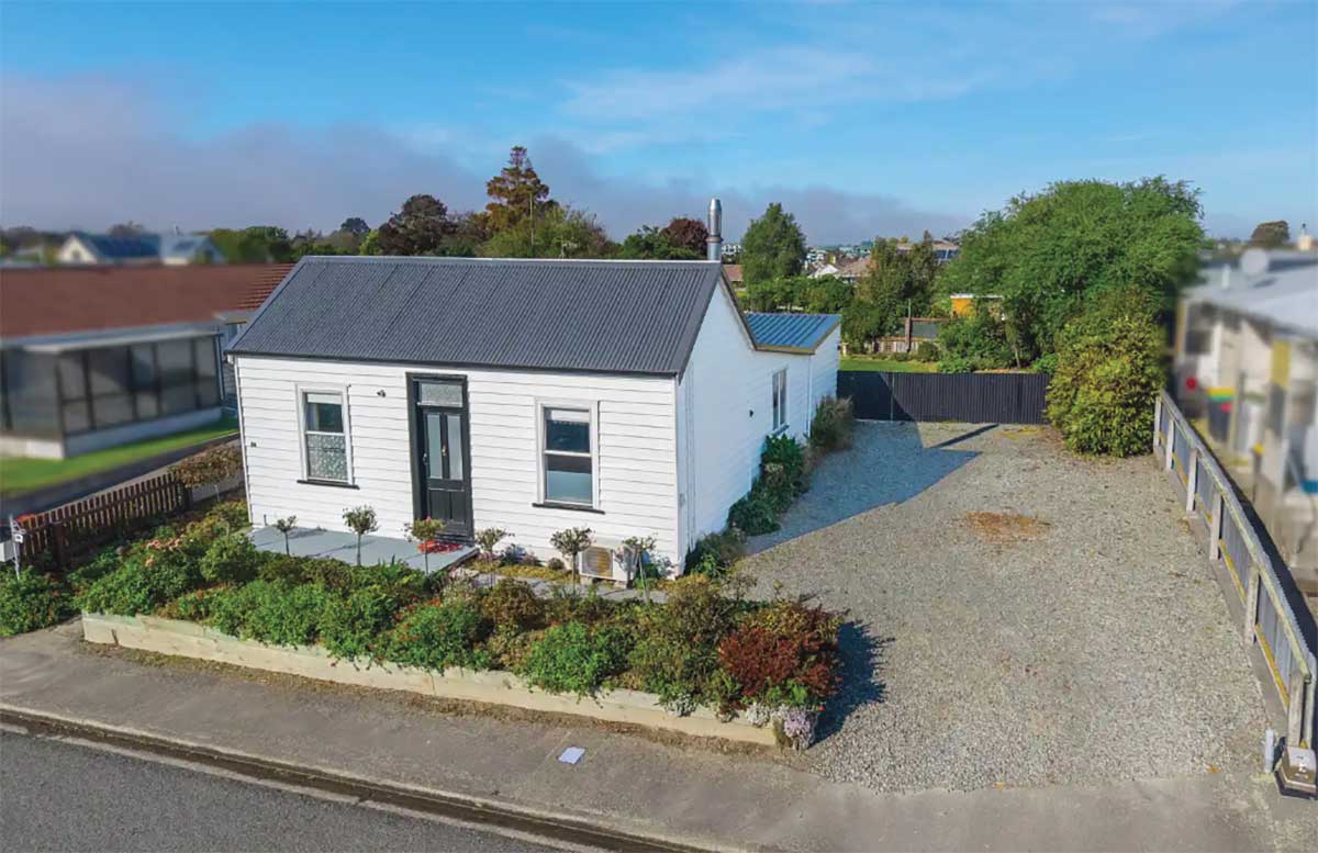
This two bedroom one bathroom Babington Street cottage went on the market in 2026, advertised by Owen Jackson of Rain & Horne - https://www.raineandhorne.co.nz/timaru/properties/24-babington-street-parkside-7910-canterbury
At first glance, 24 Babington Street is a sweet white weatherboard cottage with a tidy garden, a dark front door, and a simple roofline sitting under the big Timaru sky. Some might say it is not the most grand of dwellings in the neighbourhood... it does not have a sweeping verandah or a architect’s flourish. It is a modest timber cottage, practical, sitting close to the street with flowers boardering the street. But as I am learning on these history hunts, sometimes it is what we assume is an ordinary houses, is a home that can teach us a lot.
The house has recently gone on the market, and its age caught my eye. I asked if the owner would be okay with me writing a blog about her home, and with her blessing I started to follow a few intial clues. There is a lot of internal dialouge in my head when I read... and I found myself thinking about cottages and subdivisions. Learning about the history of the street name Babington, then clicked some other side quests into place and I realised this could be a story about engineers, surveyors, railway line progress, road boards, and the enormous amount of practical work it took to turn early Timaru from a coastal landing place into a connected town... our civic history.
Today's blog is about how I learned that not every heritage story begins with a grand building... sometimes it can begin with a small cottage and a street name...
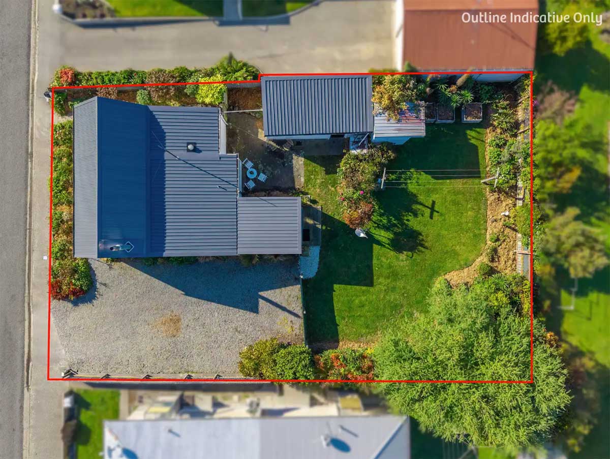
This property went on the market in 2026, advertised by Owen Jackson of Rain & Horne - https://www.raineandhorne.co.nz/timaru/properties/24-babington-street-parkside-7910-canterbury
The legal description was the first clue on the history hunt.
Today, 24 Babington Street is legally described as PT LOT 15 DP 36. That may sound dry, but it's a start, and I realiesd I needed to reach out to some historian friends to see if they could point me on the next direction. Christopher Templeton showed me a map that describes "Deposited Plan 36" as an early subdivision in this part of Timaru. This area was at one point a paddock, and later divided the land into 34 lots, and then later split again into more smaller sites. So this cottage does not just sit on a section... it sits on a piece of land that was part of a early plan of town development.
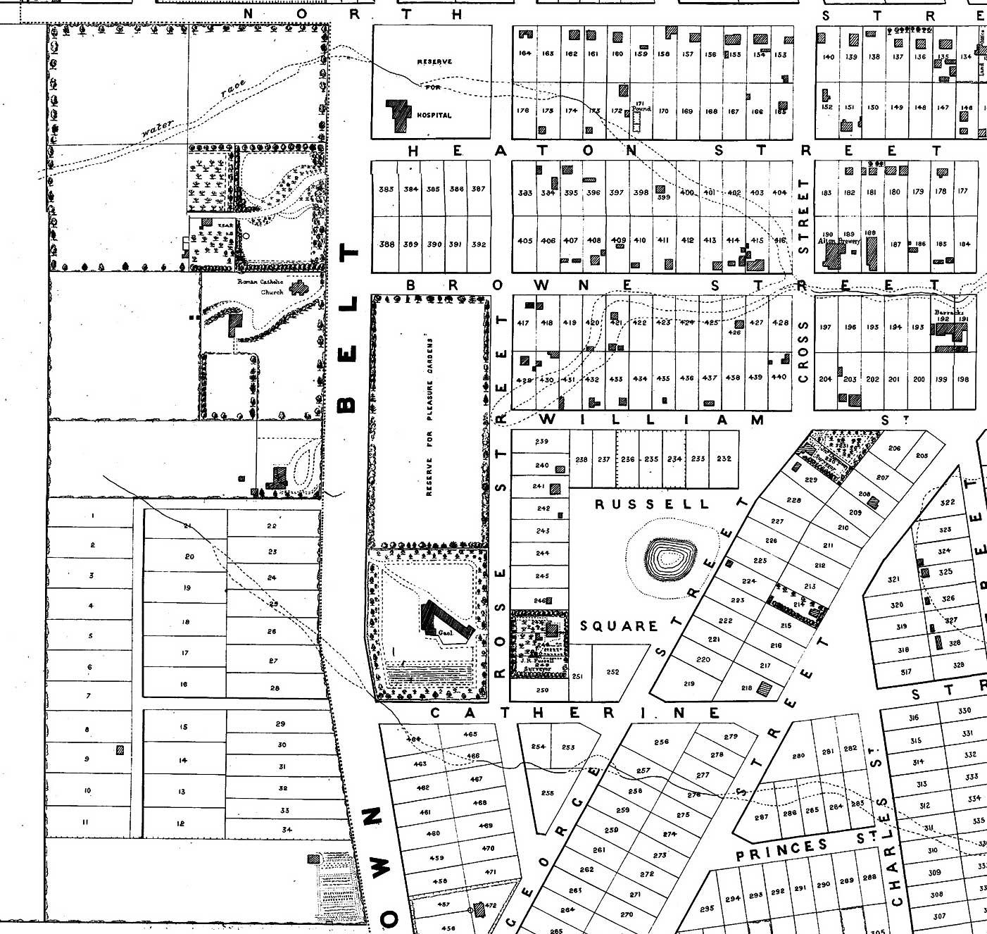
1875 Plan of Timaru Townships Canterbury Courtesy of the Timaru District Council Babington St
Before there was a house, there was a survey line
Before there was a house, there was a plan... a line on a survey and I think this is where Babington Street becomes interesting, as the street sign 'Babington Street' points to George M. Babington, civil engineer and surveyor.
According to my favourite book "The Streets of Timaru" Babington Street is believed to remember George M. Babington, a civil engineer and surveyor associated with South Canterbury public works in the 1870s. Once I started looking for him, his name began appearing in the paperwork and newspaper tenders of a young district being established and developed.
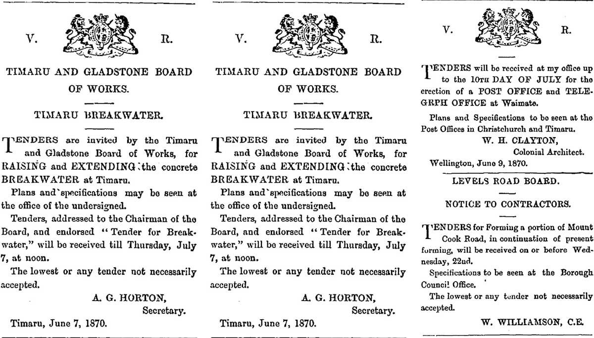
In 1873, Babington’s name appeared in tender notices for the Timaru and Gladstone Board of Works. These tender notices were the everyday machinery of civic life and part of the procurement proceedure. One called for the supply of about 200,000 cubic feet of heart kauri or tōtara, to be delivered in Timaru above high water mark. Another invited tenders for the construction of a railway between Washdyke and Pleasant Point.
“Above high water mark” takes us back to early Timaru, when goods came ashore through the landing service. Timber had to be kept beyond the reach of the tide. Public works depended on ships, carts, labour, measurements, specifications and trust. So here I am learning that the town did not simply grow because people wished it into being. I now realise in many ways it had to be engineered.

Whites Aviation photo from Retrolens - Multiple Aerial Photos stitched together by Geoff Cloake to show the coastline in 1956. Most of these roads were planned, engineerd and progressed as the town grew. In the 1870s, a civil engineer was one of the practical makers of a town. George M. Babington’s job was to help turn civic ambition into roads, bridges, railway lines and working infrastructure. He surveyed, specified, measured, advised and organised. He helped road boards and the Board of Works understand what materials were needed, where they were needed, and how public works could be built. His name at the bottom of a tender notice reminds us that Timaru did not simply grow by chance. It had to be planned, measured, costed, supplied and engineered.
In 1870, the Board publicly advertised for an Engineer to the Board, offering a salary of £300 per annum and allowing the engineer to undertake private practice. That tells us it was a formal professional appointment, not just casual advice. Page 1 Advertisements Column 7 Timaru Herald, Volume XIII, Issue 528, 18 June 1870, Page 1 https://paperspast.natlib.govt.nz/newspapers/timaru-herald/1870/06/18/1
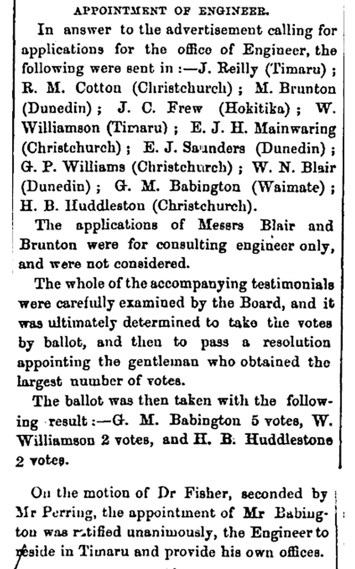
When the Board appointed Babington in July 1870, he was chosen from a field of applicants including men from Timaru, Christchurch, Dunedin, Hokitika and Waimate. The article names other engineers or applicants such as W. Williamson of Timaru, H. B. Huddleston of Christchurch, W. N. Blair of Dunedin, and others. Babington, then of Waimate, won the ballot and was required to reside in Timaru and provide his own office.
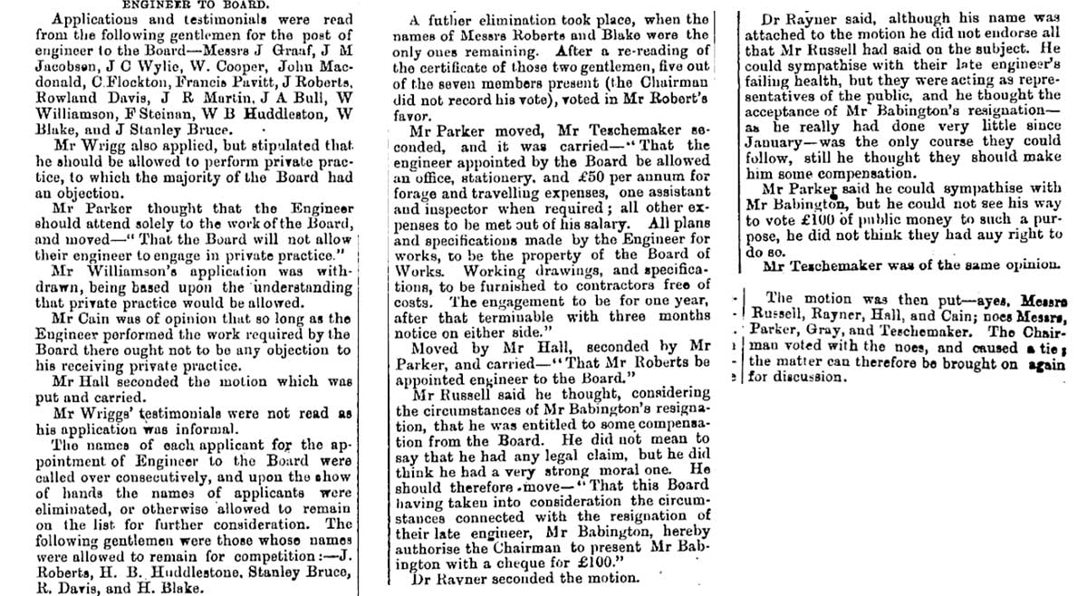
The Board itself had a chairman, elected members, a secretary, contractors, inspectors, and links with provincial government. In one 1873 meeting, the Board members are listed, and “the Engineer” is recorded as being in attendance. The same report shows Babington formally accepting the appointment, answering questions about plans and specifications, and being part of discussions about bridges, roads and landing-service equipment.
That means Babington’s role was technical, but the decisions were civic and collective. The Board set priorities, approved money, accepted tenders and debated policy. Babington supplied the engineering knowledge.
Babington was not just signing off projects. He knew the works.
The tender notice tells us something about Babington’s role. He signed as Engineer to the Board. In one notice, inland tenderers were told that the Engineer could provide the amount of timber required at particular work sites. That means he was the person who knew the works, the quantities, the sites and the requirements. He was part of the system that turned public money, local need and physical labour into roads, bridges and railways.
The Timaru and Gladstone Board of Works was one of the important public bodies of early South Canterbury. It belonged to a time when local boards, road boards and provincial government all had roles in shaping the region. Their work was not always glamorous, but it was fundamental. The Board’s projects helped make movement possible: across creeks, along roads, between rural districts and the port.
Babington’s trail also reaches into bridge work. He has been identified as the Board of Works’ civil engineer in 1872, having earlier been engineer to the Levels Road Board. He later worked for the Waimate Road Board. That is a lovely little chain of public service, from Levels to Timaru and Gladstone to Waimate. It reminds us that early engineers did not just design one landmark and disappear. They moved through a landscape of practical problems: how to cross water, how to carry goods, how to form roads, how to connect farms with markets, and how to make settlement function.
Babington as “Engineer to the Timaru and Gladstone Board of Works” and connects him to timber supply and the Washdyke to Pleasant Point railway. Source: Timaru Herald, 21 April 1873, via Papers Past, National Library of New Zealand.
Full link: https://paperspast.natlib.govt.nz/newspapers/THD18730421.2.2.6
Babington resigned and the Board appointed his successor in June 1873. - https://paperspast.natlib.govt.nz/newspapers/THD18730613.2.9
This 1873 report from the Timaru and Gladstone Board of Works shows the civic machinery behind early Timaru. Roads, railways, bridges, timber supplies, landing services, tenders and public spending were all being debated and managed through formal board meetings. George M. Babington’s resignation as Engineer to the Board reminds us that civil engineers were central to this process. They were the technical people who helped turn public ambition into practical infrastructure, shaping the roads, crossings and connections that allowed Timaru and South Canterbury to grow.
The cottage is simple, practical and modestly historic. I think it is really important piece of our built heritage.
So now I look at 24 Babington Street differently. The cottage is likely a pre 1914 dwelling, with weatherboard walls and a corrugated metal roof. Its form is simple and domestic. The front elevation is modest, with a central or near central doorway, sash style window proportions, plain timber facings and very little ornament. There is no grand villa bay, no elaborate fretwork, no showy architectural drama. It belongs to the quieter end of Timaru’s built history: small timber homes, practical sections, garden frontages, and everyday lives.
Too often, we talk about heritage as if it only belongs to the biggest, oldest or most ornate buildings. Churches, banks, theatres and civic buildings are important, of course. They give us landmarks. They show us ambition, wealth, faith and public confidence. But a town is not made only by its landmarks. It is also made by its modest houses, its street lines, its drains, its footpaths, its section boundaries, its corners, its fences, and the uncelebrated work that allows people to live ordinary lives.
A small cottage on Babington Street can help us see that. It can also help us ask better questions. Who first owned this part of Lot 15? Who built the cottage? Was it built for a worker, a widow, a young family, a tradesman, a railway employee, a teacher, or someone connected with the expanding southern edge of town? How did the subdivision change as lots were split and resold? When did services arrive? When did the road take its present shape? What did the first occupants see when they opened the front door?
Those questions still need title research, rates records, council property files and directories. But even without the full human chain, the house has already taught me something valuable. It has reminded me that built heritage is not only about architecture. It is also about infrastructure.
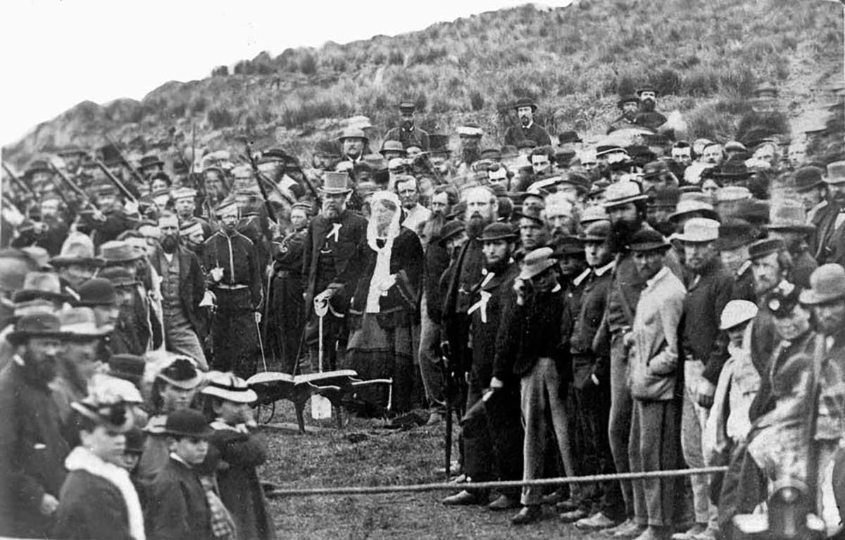
Turning the first sod of the Temuka to Timaru railway, 1871. Alexander Turnbull Library, Reference: 1/2-020116-F.
I have also learned on this history hunt, that engineers often disappear into the background of daily life
Engineers are often hidden in plain sight. We do not always remember their names because their work becomes the background of daily life. A bridge is crossed, a road is drive... most of us use them and don't really notice their design or think about the work to create them. And after a while, all that careful thinking disappears beneath the ordinary rhythm of life... when it is done well we barely notice it. But when it is now well designed, we do.
While I haven't been successful in working out who used to walk through the cottage on Babington Street's front door, or hang the washing out bac kon the line... the one history door that did open was into Timaru’s public works story.
Babington Street carries us back to George M. Babington and the public works world of the 1870s. It carries us to the Board of Works office, where plans and specifications could be inspected. It carries us to timber measured in cubic feet, to tōtara and kauri, to high water marks, to railway tenders, to road boards, to bridges, to the practical civic imagination of early South Canterbury.
And then, a few decades later, it brings us back to a small weatherboard cottage.
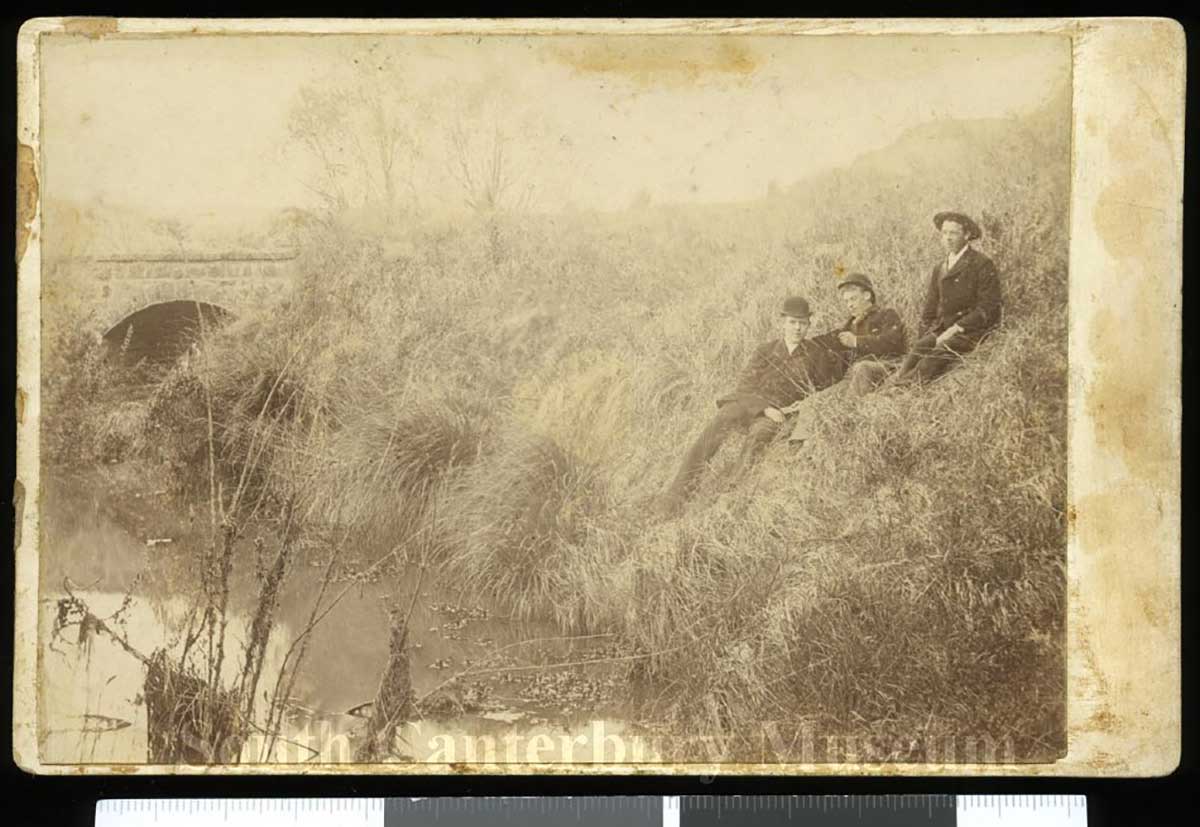
Babington is linked to road-board and bridge work, so a bridge image helps readers understand the practical civic engineering story. Bluestone bridge at Salwater Creek - Timaru c 1900 202206803 South Canterbury Museum CN 2022068

A bluestone bridge over Salwater Creek in 2026. Photography By Roselyn Fauth
One small house can reveal the wider making of Timaru
That is what I love about local history. One clue leads to another. A legal description leads to a subdivision. A subdivision leads to a street. A street leads to an engineer. An engineer leads to railways, bridges and public works. And suddenly, a little house that seemed quiet at first is speaking about the wider making of Timaru.
The street grid sits over an older Māori landscape
There is also a bigger reflection here. These colonial streets and subdivisions were laid across a much older Māori landscape, one with its own names, routes, resources and relationships. Street names often remember the people who held power in later civic systems: surveyors, engineers, politicians, landowners and public officials. That does not make them unimportant, but it does remind us to keep asking who is remembered, who is missing, and what older stories sit beneath the street grid.
This property went on the market in 2026, advertised by Owen Jackson of Rain & Horne - https://www.raineandhorne.co.nz/timaru/properties/24-babington-street-parkside-7910-canterbury
This cottage changed the way I see ordinary heritage
For me, 24 Babington Street is now more than a cottage. It is a reminder that engineers helped shape the bones of the place we live in. They measured, calculated, specified and solved. They worked with timber, stone, iron, water, gradients, roads, railways and budgets. They helped make movement possible. And once movement was possible, neighbourhoods grew.
So next time I pass a small house like this, I will try not to dismiss it as ordinary... I will look at the roofline and the weatherboards. I will look at the garden and the frontage. I will look at the street name. I will wonder about the deposited plan beneath my feet. And I will remember that every town has visible heritage and invisible heritage.
Sometimes the visible heritage is a little cottage. And sometimes the invisible heritage is the engineer who helped make the street possible.

1909 Photograph taken by an unidentified photographer employed or contracted by 'The Press' newspaper of Christchurch.Stafford Street, Timaru, with carts, horses and people in the street. The Press (Newspaper) :Negatives. Ref: 1/1-008815-G. Alexander Turnbull Library, Wellington, New Zealand. /records/29944621 former Timaru and Gladstone Board of Works Building was completed in 1874 at 95 Stafford Street, Timaru. Italianate style by architect Thomas Roberts, and contractor Thomas Machin in Timaru bluestone (basalt), brick, timber, corrugated metal. The board was created by an Act of Parliament in 1867 and held its first meeting in December that year. It was responsible for using money from land sales and other income to support public works, including roads, bridges and harbour improvements. In 1874, offices were built especially for the board, based on plans prepared by its engineer. The board was short-lived, ending in 1876 when the provincial government system was abolished. The building later became Crown property, was used by the Lands and Survey Department, had rear additions added in the mid-20th century, and is now known as the Gladstone Building, providing commercial office space. - https://www.timaru.govt.nz/__data/assets/pdf_file/0005/673880/Historic-Heritage-Assessment-Report-HHI57-Former-Timaru-and-Gladstone-Board-of-Works-Building-Category-A.pdf

Did you know? The “Gladstone” in the Timaru and Gladstone Board of Works Act 1867 was not a local town name, but the name of a South Canterbury electoral district. It was almost certainly named after the British statesman William Ewart Gladstone, reflecting the way many colonial districts were given names connected to prominent figures in Britain. The Act joined the Timaru and Gladstone electoral districts together for public works purposes, helping South Canterbury secure funding for roads, bridges and harbour development.
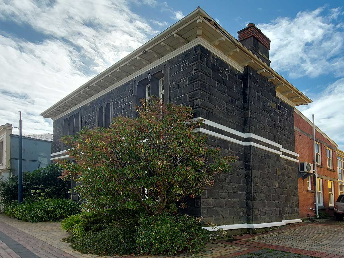
Former Timaru Gladstone Board of Works - RFauth-2026
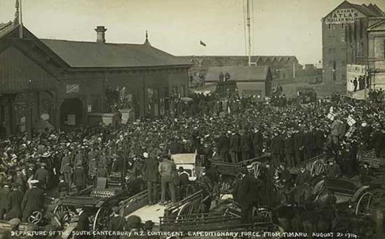
DEPARTURE OF 7TH SOUTH CANTERBURY N.Z. CONTINGENT. EXPEDITIONARY FORCE FROM TIMARU. AUGUST 24, 1914 When King George V declared war on Germany, he did so on behalf of the entire British Empire. The New Zealand Government responded quickly by assembling an initial force of 8,500 men to form the NZEF (New Zealand Expeditionary Force) to aid the Empire. South Canterbury Museum https://museum.timaru.govt.nz/explore/online-exhibits/enduring-the-inferno-south-canterbury-and-the-first-world-war/1914-south-canterbury-at-war
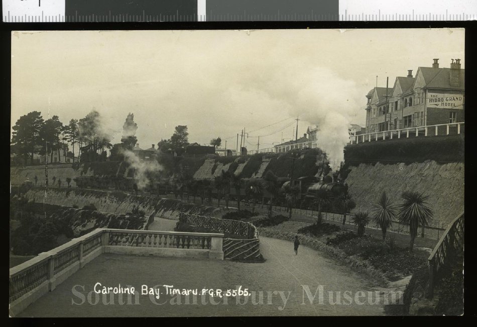
This photo is from a postcard featuring an image of the north-bound express train passing Caroline Bay, sometime between late 1915 and 1920. Taken from the Piazza looking southward at the oncoming train. The skyline features the Hydro Grand hotel (right) and the Dominion Hotel (obscured by steam). I remember someone telling me they have a memory as a young child going to the Bay to pick up their father who had returned from war. South Canterbury Museum 2011/037.32
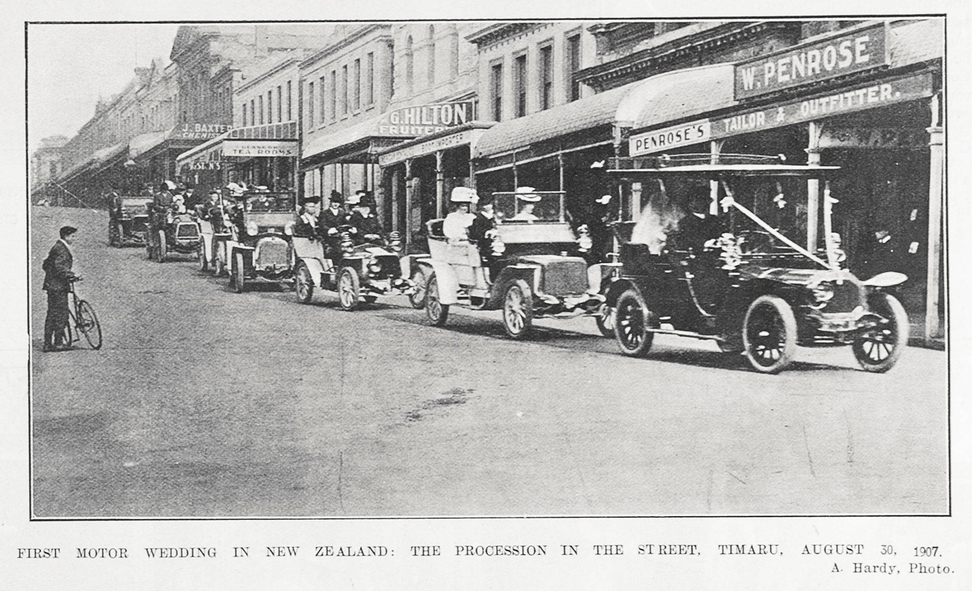
When they were desgining these roads, they at one point would have never imagined a motor car rolling over them. The former bullock trails were intended for animal power. 1907-10-17 FIRST MOTOR WEDDING IN NEW ZEALAND: THE PROCESSION IN THE STREET, TIMARU, AUGUST 30, 1907. Auckland Libraries Heritage Collections AWNS-19071017-13-03 No known copyright restrictions

Exploring a former bluestone quarry at Centennial Park in 2026 - Photography Roselyn Fauth
Side Quest: What does a civil engineer do today?
When we look at old bridges, seawalls, drains, roads, railway lines, harbour works or public buildings, we are often seeing the legacy of civil engineering. But civil engineers are not just figures from the past. They are still shaping the places we use every day.
Today, a civil engineer helps plan, design, build and look after the physical infrastructure that keeps a community working. That can include roads, footpaths, bridges, stormwater systems, wastewater networks, retaining walls, parks, playgrounds, subdivisions, flood protection, coastal structures and public spaces.
Their job is part maths, part science, part problem solving and part community care. They ask practical questions such as: Will this structure be strong enough? Where will the water go in heavy rain? Can people move safely through this space? What happens in an earthquake? How do we build something useful without causing unnecessary harm to the environment?
Civil engineers often work with architects, surveyors, planners, builders, landscape designers, councils, iwi, environmental specialists and local communities. One project might involve checking ground conditions. Another might involve designing a new cycleway, upgrading a bridge, improving drainage around a sports field, or making sure a new playground is safe, accessible and long lasting.
They also have to think about the future. Climate change, heavier rainfall, sea level rise, ageing pipes, growing towns and changing transport needs all make civil engineering more important than ever.
So next time you cross a bridge, walk along a footpath, watch water disappear down a drain, visit a playground, or drive safely around a bend in the road, there is a good chance a civil engineer has helped make that moment possible.
It is one of those professions that often hides in plain sight. When everything works, we barely notice it. But when it does not, we quickly realise how much we rely on good design, careful planning and people who understand how the built world holds together.
Side Quest: How was a civil engineer different in the 1870s?
A civil engineer in the 1870s was still trying to solve the same basic problem as one today: how do we make a place work?
But the job looked very different.
In colonial New Zealand, a civil engineer might help lay out roads, design bridges, plan drainage, oversee harbour works or set railway lines across difficult land. They were often part surveyor, part designer, part project manager and part problem-solver in the mud.
Plans were drawn by hand. Measurements were taken by hand. Calculations were made without computers. Materials were limited, communication was slow and mistakes could be hard to fix.
Today, civil engineers use digital modelling, environmental assessments, safety standards and specialist teams. They also have to think about climate change, earthquake resilience, accessibility, cultural values, long-term maintenance and community impact.
In the 1870s, the focus was often on opening up land, connecting settlements, moving goods and helping towns grow. Today, the role is also about caring for what already exists, adapting it for the future and asking better questions.
What will last? Who benefits? What happens when the sea rises, the rain gets heavier or the ground shakes?
Civil engineering has never just been about roads, bridges, drains or seawalls. It is about people, place and the future being built beneath our feet.
Sources for 24 Babington Street
Timaru District Council Property Search: 24 Babington Street, Timaru
Confirms: Property ID 8685, legal description PT LOT 15 DP 36, area 0.0506 ha, valuation details.
https://www.timaru.govt.nz/services/rates-and-property/property-search?AssessmentNumber=8685
Also accessible here:
https://www.timaru.govt.nz/pay-online/rates/details?AssessmentNumber=8685
Realestate.co.nz listing: 24 Babington Street, Parkside
Useful for current photographs, listing description, land area, bedroom/bathroom count and modern presentation.
https://www.realestate.co.nz/43039852/residential/sale/24-babington-street-parkside
Raine & Horne listing: 24 Babington Street, Parkside
Useful for the agent’s description, character cottage wording, photographs, open parking and land area.
https://www.raineandhorne.co.nz/timaru/properties/24-babington-street-parkside-7910-canterbury
QV Property Search
Useful for valuation-style built fabric details. The specific property page sometimes sits behind search/navigation, but QV identified the property as a pre-1914 dwelling with weatherboard walls and a steel/G-iron roof during the earlier lookup.
https://www.qv.co.nz/property-search/
Sources for George M. Babington and civic engineering
Papers Past, Timaru Herald, 5 May 1873, tender notice
Confirms Babington as Engineer to the Timaru and Gladstone Board of Works and links him to the railway between Washdyke and Pleasant Point.
https://paperspast.natlib.govt.nz/newspapers/THD18730505.2.2.6
Papers Past, Timaru Herald, 21 April 1873, tender notice
This is the notice matching your clipping: public works timber supply and railway tender, signed by G. M. Babington.
https://paperspast.natlib.govt.nz/newspapers/THD18730421.2.2.6
Papers Past, Timaru Herald, 18 April 1873, railway tender notice
Another appearance of the Washdyke to Pleasant Point railway tender.
https://paperspast.natlib.govt.nz/newspapers/THD18730418.2.2.6
Papers Past, Timaru Herald, 28 April 1873, railway tender notice
Another useful version of the same Board of Works tender trail.
https://paperspast.natlib.govt.nz/newspapers/THD18730428.2.2.6
Papers Past, Timaru Herald, 28 April 1873, Land Transfer Act surveyor’s licence notice
Confirms George M. Babington of Timaru was licensed as a surveyor under the Land Transfer Act, with office at the Railway Offices, Timaru.
https://paperspast.natlib.govt.nz/newspapers/THD18730428.2.2.3
Papers Past, The Star, 9 October 1871, turning first sod of the Timaru and Temuka Railway
Useful context for the railway ceremony and Babington’s railway world.
https://paperspast.natlib.govt.nz/newspapers/TS18711009.2.10
NZ History: Turning the first sod of the Temuka to Timaru railway, 1871
Good accessible context for the 1871 railway ceremony involving Mrs Cain.
https://nzhistory.govt.nz/media/photo/first-sod-temuka-timaru-railway-1871
Sources for the Timaru and Gladstone Board of Works
Timaru District Council heritage assessment: Former Timaru and Gladstone Board of Works Building
Useful for the Board’s wider role in public works between 1867 and 1876.
https://www.timaru.govt.nz/__data/assets/pdf_file/0005/673880/Historic-Heritage-Assessment-Report-HHI57-Former-Timaru-and-Gladstone-Board-of-Works-Building-Category-A.pdf
Heritage New Zealand: Former Gladstone Board of Works Building, 95 Stafford Street
Useful for formal heritage listing context.
https://www.heritage.org.nz/list-details/327/Listing
Timaru Civic Trust: Gladstone Board of Works Building
Useful local built-heritage summary.
https://www.timarucivictrust.co.nz/heritage-nz-listed-category-1.html
WuHoo Timaru: Former Timaru and Gladstone Board of Works Building
Useful if you want to cross-link to your own heritage walk content.
https://wuhootimaru.co.nz/cbd-heritage-walk/418-gladstone-board-of-works
Sources for Babington, bridge work and wider public works
Timaru District Council heritage assessment: Saltwater Creek/Bluestone and Iron Bridge
Very useful. It states George Mathew Babington was the Board of Works’ civil engineer in 1872, earlier engineer to the Levels Road Board, and later in the service of the Waimate Road Board.
https://www.timaru.govt.nz/__data/assets/pdf_file/0004/673897/Historic-Heritage-Assessment-Report-HHI74-Bluestone-and-Iron-Bridge-Category-B-NEW.pdf
WuHoo Timaru: Bluestone Bridges and the Civic Work of Getting Across
Useful if you want to connect this blog to your existing Babington/bridge storytelling.
https://wuhootimaru.co.nz/blog/1330-bluestone-bridges-and-the-civic-work-of-getting-across
Aoraki Heritage Collection: Saltwater Creek
Useful place context for Saltwater Creek/Ōtipua Creek.
https://aorakiheritage.recollect.co.nz/nodes/view/5862?type=all